Description
USC11_0001
In compiling these vocapularies I was actuated, a good many years age, by discussions in the letterpress of newspapers on the origin and meanings of aboriginal place names, many of which were unenlightening and some actually nonsensical, such as the trite story of the place name Degilbo being the reverse spelling of the work obliged, and the fabricated stories as to its origin. Having in my early youth, some sixty odd years ago, on the Mary River, gained some run [illegible] knowlege of the Kabi language and the peculinrities of its [illegible], I went into the matter and obtained information from all available sources. I was assisted in this by the study of vocabularies compiled by a[illegible] Curr, John Mathews, Rev. W. Ridley Constance Petrie, John Allen, [illegible] Enid Bell, E. Armitage , and E.M. Hanlon.
USC22_0003
Fraser Island forms Hervey Bay (named by Cook on 21st May, 1770, after Captain Hervey) and "Great Sandy Strait," which is 28 miles in length from Inskip Point to the mouth of the Mary River.
USC60_0001
For about 40 miles north from Wide Bay Bar to Moon Point, Fraser Island is separated from the mainland by Wide Bay Harbour and Great Sandy Strait and shelters the Mary River Heads.
USC60_0006
Maryborough marine beds outcrop at Mary River Heads and Woody Island and a trough or fold appears to account for the Straits and Tin Can Bay, so that it appears fairly certain these marine beds underlie much of Fraser Island, together with their associated Burrum Coal measures, geologists have much to verify of the island's true geological horizons, and they would dearly love to sink a few test bores which might even reveal "black gold" at no great depth.
USC60_0008
To me, it appears fairly obvious that the Mary River has played a very important part in this most interesting phenomenon, as the coloured Army ordanance maps clearly indicate. The shore near most of the large, flowing creeks of the western watershed of Fraser Island is mangrove granished and these streams, most of which run strongly and perenially, seem to have played their part in arresting the silts borne seawards from the oft-turgid stream of the Mary. This is most noticeable in the great silttrap formed by Yidney Bay.
USC60_0012
Throughout these years other logging was carried on along most of the West coast from Yankee Jack to Bowarrady and is amply test - ified to by the old stumps - including those of Cyprus Pine which was also used for piles, many of which can be seen in the Mary River and Straits.
USC60_0015
having perhaps been exterminated by the blacks in bygone days, as only a dozen years ago I saw a mob of Kangaroos on Kangaroo Island at the confluence of the Mary and Susan Rivers, and those too seem to have been wiped out.
USC91_0014
5.5.3. There is a need for marine research to be undertaken on Fraser Island. It is proposed that when the Forestry Department phases out of Fraser Island, the existing support facilities at Ungowa should.be redeveloped to focus on the urgent marine research needed on Great
[column 2]
Sandy Strait and the Mary River estuary.
USC281_0003
Fraser Island forms the eastern side of Hervey Bay, shelter- ing the bay and the false delta of the Mary River from the prevailing strong south easterly trade winds and providing safe small boating under ideal conditions.
USC281_0004
Although Flinders suspected Fraser Island to be an island he marked it on his maps as "The Great Sandy Peninsula". It was not until Andrew Petrie sailed his risky craft through Sandy Strait in 1842 to camp on Fraser Island, and to subse- quently discover the Mary River, that it was realised that Fraser Island was in fact, an island. In 1847 Lt. Dayman, in the tiny "Asp", sailed right through Sandy Strait.
USC281_0008
THE ABORIGINES
Fraser Island is believe to have supported between 2,000 and 3,000 aborigines in 1850. They were all members of the Kabi nation whose territory extended over the whole of the Mary, Burrum, Noosa, Maroochy and Mooloolah River basins. The Kabi nation was divided into 19 sub tribes or clans, each with its own tribal lands with clearly defined boudaries. The Butchulla tribe is reported to have occupied Fraser Island.
USC281_0009
The timber is hauled to the tidal creeks south of Moon Point, and loaded onto barges to be punted up the Mary River to the Maryborough sawmills. Gone are the exciting days of the log crafts, the bullock teams, Mackenzie's Sawmill, the tram- lines with their steam locos, and timber getters' skirmishes with the aboriginals. Yet the timber industry has sustained an interest in Fraser Island throughout its history.
USC295_0002
In 1842 when the penal settlement closed and Queensland was being opened up for free settlement, Andrew Petrie led a party to explore and discover the Moonaboola River (The Mary) which they had heard aborigines talk about in Brisbane. They wanted to see if it was suitable for free settlement, particularly grazing.
USC295_0005
One of the exploits of Z Force related by Mr Allen Russell, former manager of Dillingham Mining Company, who had trained on Fraser Island, was that a unit had to leave the camp, sneak into Maryborough by canoe and mark the shipping in the Mary River with a cross where they could have planted and detonated explosive charges.
USC295_0011
In 1874 after further wanderings including work in Cardwel rain forests where he contracted Malaria, Armitage returned to Maryborough to join in Cedar and Pine logging on Mt. Bopple and along the Mary River. He records -
[right column] " A dry season prevented my getting any down to market the first year (1874), but the next year more than made up for it. A big flood came in February. I had then over 2,000 logs in the river, the flood carried many of them down the river as far as the sea, but most of them were washed up on to the farms and into the scrubs along the river, and gave me five months' extra work with a party of three men and a team of bullocks to get them hauled back into the river and down to the sawmills."
USC313_0003
Besides being relatively easy to cut, the softwoods had the added advantage of being able to float. Once at the beach, logs could be rafted together and simply punted across the Great Sandy Straits to the Mary River (Moonaboola). Tugs were then used to haul the rafts of timber across the straits to Dundathu. Pettigrew converted a sailing vessel, the [start italics] Granite City [end italics], for this purpose; another of his vessels, the Hercules, was used to take Dundathu employees and their families for picnics at White Cliffs on Fraser Island.
Related Subjects
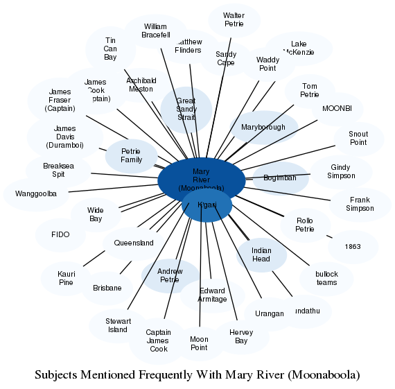
The graph displays the other subjects mentioned on the same pages as the subject "Mary River (Moonaboola)". If the same subject occurs on a page with "Mary River (Moonaboola)" more than once, it appears closer to "Mary River (Moonaboola)" on the graph, and is colored in a darker shade. The closer a subject is to the center, the more "related" the subjects are.