Description
USC21_0002
The northern block to extend from Sandy Point to Triangle Cliff on the west and from Indian
Head to a point on the east coast due east of Sandy Point; to include 100 acres freehold at the mouth ofBrowarady Creek, with right to all timber and natural products included within the two areas.
USC22_0003
Two miles from the south end it is 4 miles across, and thence northwards averages about 8 or 9
miles to "Mooan Point," where it broadens to 15 miles, contracting thence northward to 8 miles at IndianHead, 3 miles in the bight of Platypus Bay, and widening at "Rooney Point" at 8; thence tapering toSandy Cape.
From Sandy Cape to Indian Head is a distance of 23 miles.
---
The first mention of any part of Fraser Island in history appears in Captain Cook's log-book for
20th May, 1770. On that day the immortal navigator's ship "Endevour" was passing northward at adistance of 5 miles off a cliff-faced precipice forming the sea front of a beautiful green headland backedto the westward by sand dunes and sandhills.
On that headland a large number of aboriginals gathered to gaze at the huge mysterious white-
winged object passing along the surface of the ocean like a gigantic pelican.
Cook saw them through the telescope, and forthwith named the locality "Indian Head," as all
savages were in that age described as "Indians."
It is somewhat remarkable that the other men who kept journals on board the "Endevour"
Lieutenant Hicks, Gunner Forwood, Lieutenant Clerke, Francis Wilkinson (master's mate), MidshipmanBootie, and the writer of an anonymous log, have no reference to Indian Head, though all mention Sandy Cape and Breaksea Spit, only 23 miles away.
USC22_0007
Moonall: small bird (Moonal is one of the names of Indian Head)
USC22_0008
Indian Head: Cowwoi, Walarr, Tukkee and Moroll (Walarr = basalt, and Tukkee = a stone)
USC47_0001
Moonall Indian Head ?
Cowwoi Indian Head ?
Walarr Indian Head Basalt
Tukkee Indian Head Stone
USC60_0001
Captain James Cook chartered the eastern shoreline on his voyage up the coast in 1770. He named Indian Head on 19th May, because like Columbus and the other old explorers, he called all natives Indians, and many aborigines could be seen by him from the "Endeavour's" deck, mustered in large numbers on this imposing headland. Incidentally, Indian Head is ony about 15 miles short of being the most easterly point of the main Australian land-mass.
USC60_0006
Only on large creek (Eli) flows east into the ocean, but there are many small streams and innumerable soakages , though no small creeks occur north of a point six miles south of Indian Head. By contract, on the western slopes there are many large flowing creeks. Waterspout Creek was so named because a pipe from it enabled small steamers to tie up and fill their tanks direct from it . (The "Muriel Belle" was one of the last to do so.)
---
The only true rocks which occur on Fraser Island are the volcanic formations of Indian Head and Waddy Point, just three miles apart, plus the group of three much smaller features between the above headlands, appropriately named Middle Rocks. The above two imposing bluffs raising their frowning vertical, basaltic cliff's majestically from the surging Pacific, to a height of over 160 feet , are impressive features, particularly as they are sloping downwards inland for about 20 chains to fade away into low extensive belts of ever changing "sandblow", marshalled by the very strong winds into great, wave-like formations.
The exposed rocks on Indian Head evidence severe weathering, and rich volcanic loam caps most of tbe headland, but the northern few chains are practically bare rock. The headland carries small patches of sparse and stunted beach she-oak and pandanus, but is densely grassed with 1awn-like salt couch on the plateau-like crest. The grazing is in keen demand by mobs of brumbies, numerous "stallion mounds" testifying not on1y to this, but to be the tidy and orderly habits of' these "lords of equine creation", who so painstakingly avoid undue fodder pollution by concentratin their droppings in neat stacks! This practice is, course, not common to Fraser Island brumbies only .
Indian Heads covers less than ten acres. In all. there are probably not more thatn [sic] 20 or 30 acres of exposed basalt rock on the island, but it is obvious that some of the losw sand blows adjoining are underlainby rock. At Indian Head these rocks are bared or covered from time to time by wind and water and the letter, when cyclones and extremely high tides coincide, must practically isolate the headland, for buried under the sand is to be found large quantities of driftwood, apart, of course, from trees buried by blown sand near the tree line. In one night our truck amassed a two foot high drift of fine sand in its lee, due to a 30 knot...
USC60_0007
...sou' easter. Indian Head can only be reached by vehicles using the beach or on foot from Waddy Point, but the latter can be approached by a rough track from Wathumba Creek on Platypus Bay, some ten mi1es distant.
SOIL:
The soildof [sic] Fraser Island actually comprises fine sand with heavy admixture of' humus in the top few feet, the latter being more pronounced in the better scrubs than in the poorer carrol scrubs and forest. Below three or four feet extremely white sand is encountered, but many of the sandcliffs display a handsome variety of coloured sands. The early morning sunlight on some of the yellow and reddish cliff's south from Indian Head, produces colourings to gladden the heart of a central Australian painter. Lime and other minerals appear to be lacking in the scrub soils.
---
BEACHES:
The beaches of Fraser Island are one of its notable features and the so -called 75 mile beach runs from Hook Point at the extreme south end to Sandy Cape. It is hard and firm at low tide, but its continuity is severely broken by the basaltic rock of the Indian Head - Waddy Point region, and by great numbers of protruding soft sandstone rocks at a number of places south from Indian Head.
---
In the rattling, bounding, parky Model T Ford, or in a modern motor truck the 38 mile run along the beach from Eurong Road to Indian Head can prove really thrilling, and to take undue risks and be caught by a great ocean roller whilst rounding rocks can easily spoil the trip and damage the motor.
USC60_0008
On the ocean beach and near rocks, Tarwine Bream seems to be the most common fish, weighing up to 5 lb s ., but Jew and sand Whiting are common also . Off the "Maheno's" stern several of the latter can be caught with one bait ! Fair fishing can be had over the rock ledges on the Straits side, but easily the best fishing on the island is from the great basalt rocks at Indian Head and Waddy Point. However, the "fly in the ointment" is the great difficulty of getting there - and of course it's easier to get weatherbound or sand-bogged - " boodled" as they say on the island.
---
Near Indian Head are great beds of "Wong" shells, buried in the sand at different levels , and exposed by gales and showing evidence of having been roasted. These are probably the remains of untold ages of feasting by the natives.
USC60_0016
At Indian Head there is a rough shed used by campers, but the Happy Valley Tourist Camp, built in the middle thirties by Mr. Stan. Warry, not far from the "Maheno" on the same ocean beach, did not succeed in becoming permanently established and is now but a pleasant memory.
USC281_0002
[notations on map]
The Remainder is all Sand Hills
LAKES
N&S Ngkala
610 SPOT HEIGHTS OF DUNE CRESTS
ABORIGINAL FORDING PLACE
INDIAN HD.
USC281_0003
Fraser Island is the largest Island off the East Australian coast. It is 617 square miles in area and with the exception of Indian Head and Waddy Point is composed entirely of sand, with some hills reaching almost to 800 feet in height.
USC281_0004
Cook named Indian Head, Sandy Cape and Breaksea Spit and Cook describes the past of the coast as moderately high and very barren, there being great patches of moveable sand many acres in extent through which appeared in some places the green tops of tree half buried and in others the naked trunks of such as the sand had destroyed.
---
For the angler there are all the thrills of fishing from the rocky headlands at Indian Head or Waddy Point, form the expansive surfing beaches (one stretches unbroken for over 60 miles) or form the quieter inlets, estuaries and bay side beaches.
USC281_0007
[photo caption]
Looking south to Indian Head from dunes behind Waddy Pt.
USC281_0009
[photo caption]
A high ridge of coloured sand, south of Indian Head.
USC281_0010
The forestry department regards beauty spots as having the same status as National Parks but they have no statutory basis and therefore they are liable to the same mining as any other parts of State forests. For example, forestry beauty sport totalling 1835 acres, including Waddy Point, Indian Head (which were not excised from the state forest in 1963) and Wabby Lakes, are subject to mining lease applications.
USC295_0003
Teddy Brown, I think, but won't swear was the coloured sand artist who could make anything in a bottle. Dad engaged him often to tail horses. He was an artist with a fishing line and could dive overboard and catch a turle [sic] and bring it to the surface very easily. So could Banjo and many more. Teddy was one of the blacks who buried cases of pickles etc from the "MARLOO", on a trip to Indian Head and Middle Rock. Some time after the wreck we had Teddy, and he promised he would get us plenty of pickles. However he dug for hours in many places with no luck, so we didn't have pickles but we did have plenty of fish and
oysters.
Although we always talked of going to Indian Head, it was Middle Rock we always camped at and would be very careful on arrival to be quiet and not show ourselves to the sea until low tide. Otherwise fish in the Aquarium would be frightened out to sea.
USC295_0004
Much exploration was done but although much heavy mineral was located on the Eastern side of the Island, the western side in the Krambruk Dune lands was so lacking in any heavy minerals or other impurities that two separate Mining Companies, Thiess Brothers and later Dillingham Constructions, sought leases of up to 2000 hectares to mine and extract silica sand for industrial purposes. Although both companies relinquished their claims, it is thought that this is one of the largest deposits of pure high grade silica sand in the world. Fortunately however in December 1971 this area was proclaimed a National Park, except for the eastern coastal strip one kilometre wide which is still covered by rutile-zircon leases as far south as Indian Head.
USC295_0010
Talking of the buggy at night, returning from Indian Head, Dad, Brother, Moncher and myself, brother and I riding, Dad driving buggy - the night was so dark coming through Eurong Scrub and and the track was not over wide - I was riding a grey mare and Tom was wearing a white shirt, by riding one on each wheel track directly in front of the buggy and because the horses were both dark coloured and not discernible in the dark, Dad could see my horse and Tom's shirt and so keep a safe course.
USC295_0021
When riding along the ocean beach as we frequently did travelling from Eurong to Bowarrady or to Indian Head it was commonplace to have ten or more dingoes following. Fresh ones joined and others dropped out as they reached their territory boundaries. (Dingoes travel great distances when necessary. In the west I have known them to travel 40 miles to and from water).
USC297_0002
In contrast, Fraser's long line of beach was traversed, stopping at intervals to absorb the spectacular coloured sand dunes, particularly the eroded cliff line named The Cathedrals, shipwreck "Maheno" and the volcanic intrusion of rocks that make up Indian Head.
USC617_0004
[notation on map]
1770 Indian Head Named by Captain Cook when he saw "Indians"
USC926_0001
Likewise there are no plans being advanced for addressing the most serious degradation of Indian Head and many other very obvious sites of degradation on Fraser Island.
USC1022-0004
The Quaternary sand dunes have buried a low hilly landscape cut in Mesozoic sediments with minor intrusions of igneous rocks. These pre-Quaternary rocks which underlie the extensive dune deposits lie at depths up to about 50 metres below the present sea level (Queensland Government 1990). Some of the buried parts of this buried landscape are exposed on Fraser Island as rocky headlands, for example, Waddy Point, Middle Rocks and Indian Head, or in the intertidal zone, for example, exposures of fossiliferous marine chert on the western side of Fraser near Bun Bun creek (Thompson 2000;
Queensland Department of Environment and Heritage 1994).
Related Subjects
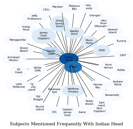
The graph displays the other subjects mentioned on the same pages as the subject "Indian Head". If the same subject occurs on a page with "Indian Head" more than once, it appears closer to "Indian Head" on the graph, and is colored in a darker shade. The closer a subject is to the center, the more "related" the subjects are.