Description
USC22_0003
Two miles from the south end it is 4 miles across, and thence northwards averages about 8 or 9 miles to "Mooan Point," where it broadens to 15 miles, contracting thence northward to 8 miles at Indian Head, 3 miles in the bight of Platypus Bay, and widening at "Rooney Point" at 8; thence tapering to Sandy Cape.
USC22_0007
SMALL INTERMEDIATE CREEKS FROM MOOAN POINT TO WATOONBA
Manoolcoong: death adder
Taliah: breadfruit
Anniah: black earth
Yeenamba:
Goochee: iguana
Weeralli: canoe paddle
Ahmoorgan: Ahmoo, the breast
[Birrabee Creek|Birrabee]]: small Macrozamia
Coonggwal: water
Moondoora: red ant
Yindeering: kingfisher
The last two are the first north of Mooan Point.
USC22_0008
PLACE AND NAMES
Round Island: Weenandin
Big Woody: Tooliewah
Little Woody: Nalangoora (accent on lang)
Picnic Isles: Picnic Isles|Gneer]]
Urangin: Urannyin
Pialba: Bagillba - bagill = sea mullet
Pialba: also Borillba
Point Vernon: Geewoongin, gee-woong-in
Indian Head: Cowwoi, Walarr, Tukkee and Moroll (Walarr = basalt, and Tukkee = a stone)
Waddy Point: Binngih
Two intervening reefs: Bereb-baree and Callah (a cotton bush)
Sandy Cape: Carree and Manann
White Cliffs: Balargan
Moon Point: Mooan and Coolboo
Stewart's Island: Coonang-oor
USC47_0001
Prominent points of the Island:
Binngih Waddy Point ?
Mooan Moon Point ?
Coolboo Moon Point ?
USC60_0001
It is 77 miles long by the maximum of 14 and minimum width of 3 miles and averages 9 to 10 miles wide from its greater part. It comprises about 393,000 acres, of which only about 15 per cent carries commercial forest, although a very high percentage is timbered country. For about 40 miles north from Wide Bay Bar to Moon Point, Fraser Island is separated from the mainland by Wide Bay Harbour and Great Sandy Strait and shelters the Mary River Heads.
The strait is comparitively shallow and only navigable at the "halfway" along its course to small craft at low tides, though there are areas, mostly at either end, 60 to 90 feet deep.
From Moon Point the island sweeps north-easterly to form the deep waters of Platypus Bay, forming the eastern part of the 45 mile wide Hervey Bay, in which the Navy carries out manoeuvres and whose western limit is Burnett Heads.
USC60_0008
TIDES:
The tides flow strongly in two directions through the Strait,
the great mouth of Hervey Bay acting in a measure like the Bay of Fundy, narrowed to seven miles between Urangan and Moon Point, to give rises of up to about eleven feet near the Moon Boom Islands, where they meet the ,water forced through the ¾ mile wide entrance of Wide Bay Harbour. At the point of juncture there is a considerable over-run of tide, and under certain conditions of variable factors, slack water has been known to last several hours. What effect this has had on the geography is graphically illustrated on the detail map of the locality , for here we see a pronounced delta formation half way along a stream, that stream being the narrow part of the Great Sandy Strait.
USC60_0009
VEGETATION:
The vegetation falls into three main types.
1. The main timber belt-about 42 miles in length, and from one to five miles wide.
2. The Coastal Cyprus area, which flanks the western shore for 40 miles (approximately) from Moon Point to Hook Point, and which is from a quarter to two miles in depth.
3. The Waste Lands, which extend over the major part of the island and fringe the whole of the east coast, and on the west coast extend in a long, very irregular, and broken manner between the Cyprus belt and, the main timbered area.
USC91_0005
The Great Sandy National Park should include all water between Moon Point and Rooney's Point.
USC91_0043
settlement at Wathumba Creek, Moon Point, Woralie Creek, or Dundonga Creek, all of which have been
proposed. These areas are not only unsuitable for management reasons, but they would exacerbate the difficulty of control of people having access to the island. They are also in insect
(mosquitoes, midges) infested areas generally unsuited for comfortable human settlement
USC281_0003
Fraser Island is seventy-seven miles from Sandy Cape, its most northern feature, to Hooh Point in the south. Although it has a maximum width of fourteen miles its average width is less than seven miles. The open beach runs almost ninety miles along the east coast. In the lee of the island fronting Hervey Bay sheltered beaches run from over forty miles north from Moon Point. South of Moon Point the tidal wetlands provide a rich nursery for the healthy fishing industry of Hervey Bay, as well as loading points for the abundant timber harvest.
USC281_0009
The timber is hauled to the tidal creeks south of Moon Point, and loaded onto
barges to be punted up the Mary River to the Maryborough sawmills. Gone are the exciting days of the log crafts, the bullock teams, Mackenzie's Sawmill, the tram- lines with their steam locos, and timber getters' skirmishes with the aboriginals. Yet the timber industry has sustained an interest in Fraser Island throughout its history.
Related Subjects
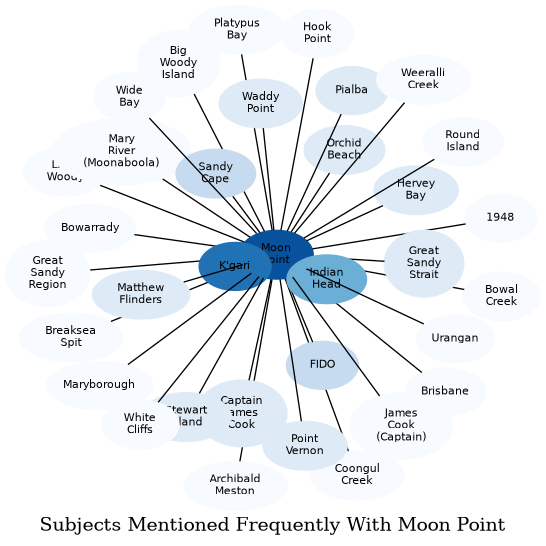
The graph displays the other subjects mentioned on the same pages as the subject "Moon Point". If the same subject occurs on a page with "Moon Point" more than once, it appears closer to "Moon Point" on the graph, and is colored in a darker shade. The closer a subject is to the center, the more "related" the subjects are.