Pages
Indexed
(seq. 1)
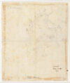
Survey of CAPE ANNe 1799
Anderson's Point; Holibut Point; G L Cove; Gallop's Jetty; Lane's C; Plum C; Hodgkin's Cove; Neckpains Neck; Wigwam Point; Squam; South side of Squam River; Braee's Cove; Salt Island; Milk I; Thatcher's Island|Thatcher's I]]; Bond; Straight Mouth; Sandy Bay; Pidgeon C; Saleosel; Pigeon Hill; CAPE ANN; Hand stream empties in to mill river & thence into Squam River pond
North; Inch 1/2 to a Statute Mile