Pages That Mention Yaquina Bay
Yaquina Bay Built 1869 to 1871
3
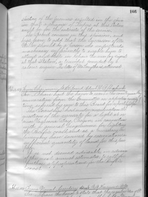
(in)spection of the premises resulted in the opinion that a change of Keepers at this Station would be for the interests of the service. The Board concurs in this opinion, and begs leave to add that the successor of Mr. Miller should be a person who understands machinery sufficiently to enable him to attend and keep in repair the new fog-signal at that Station, a trumpet sounded by a caloric engine. The letter of Mr. Smythe is returned. ______________________________________________
Feb 25, 1869
From Chairman L.H. Board Adml. W.B. Shubrick
Yaquina Bay - necessity of light for
Sir: I have had the honor to receive the communication from the Committee on appropriations (???), referred by you to this Board for report. The Board has had under consideration the question of the necessity for a light at or near Yaquina Bay, Oregon, in connection with a general programme for lighting the Pacific coast, and as a necessary preliminary have secured by reservation a sufficient quantity of land for this purpose. It is not deemed advisable, in advance of the next annual estimates, to call for further appropriations for the Pacific coast ______________________________________________
Feb 25, 1869
From Naval Secretary Adm. A.A. Harwood. U.S.N Notice of Board (Bd ???)
Sir: I have the honor to state that the regular
Coast Guard District narrative histories 1945
21
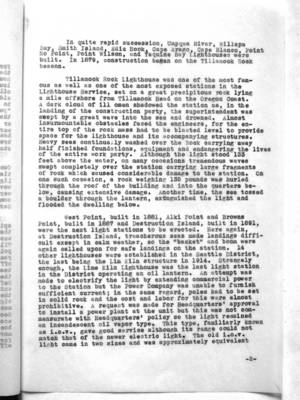
In the quite rapid succession, Umpqua River, Willapa Bay, Smith Island, Ediz Hook, Cape Arago, Cape Blanco, Point No Point, Point Wilson, and Yaquina Bay Lighthouses were built. In 1879, construction began on the Tillamook Rock Beacon.
Tillamook Rock Lighthouse was one of the most famous as well as one of the most exposed stations in the Lighthouse Service, set on a great precipitous rock lying a mile offshore from Tillamook Head on the Oregon Coast. A dark cloud of ill omen shadowed the station as, in the landing of the construction party, the superintendent was swept by a great wave into the sea and drowned. Almost insurmountable obstacles faced the engineers, for the entire top of the rock mass had to be blasted level to provide space for the lighthouse and its accompanying structures. Heavy seas continually washed over the Rock carrying away half finished foundations, equipment and endangering the lives of the entire work party. Although the light stood 133 feet above the water, on many occasions tremendous waves swept completely over the station carrying large fragments of rock which caused considerable damage to the station. On one such occasion, a rock weighting 135 pounds was hurled through the roof of the building and into the quarters below, causing extensive damage. Another time, the sea tossed a boulder through the lantern, extinguished the light and flooded the dwelling below.
West Point, built in 1881, Alki Point and Brown Point, built in 1887 and Destruction Island, built in 1891, were the next light stations to be erected. Here again, at Destruction Island, treacherous seas made landings difficult except in calm weather, so the "basket" and boom were again called upon for safe landings on the station. 14 other lighthouses were established in the Seattle District, the last being the Lim Kiln structure in 1914. Strangely enough, the Lime Kiln Lighthouse was the last light station in the District operating an oil lantern. An attempt was made to electrify the light by extending commercial power to the Station but the Power Company was unable to furnish sufficient current; in the same regard, poles had to be set in a solid rock and the cost and labor for this were almost prohibitive. A request was made for Headquarters' approval to install a power plant at the unit but this was not commensurate with Headquarters' policy so the light remained an incandescent oil vapor type. This type, familiarly known as i.o.v., gave good service although its range could not match that of the newer electric light. The old i.o.v. light came in two sizes and was approximately equivalent
-2-
42
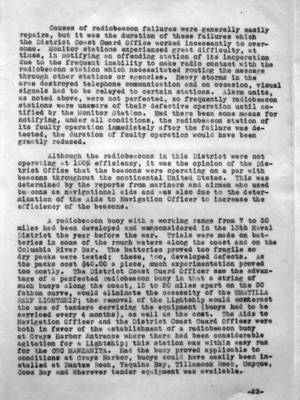
Causes of radiobeacon failures were generally easily repairs, but it was the duration of these failures which the District Coast Guard Office worked incessantly to overcome. Monitor stations experienced great difficulty, at times, in notifying an offending station of its inoperation due to the frequent inability to make radio contact with the radiobeacon station which necessitated routing the message through other stations or agencies. Heavy storms in the area destroyed telephone communication and on occasion, visual signals had to be relayed to certain stations. Alarm units, as noted above, were not perfected, so frequently radiobeacon stations were unaware of their defective operation until notified by the Monitor Station. Had there been some means for notifying, under all conditions, the radiobeacon station of its faulty operation immediately after the failure was detected, the duration of faulty operation would have been greatly reduced.
Although the radiobeacons in this District were not operating at 100% efficiency, it was the opinion of the District Office that the beacons were operating on a par with beacons throughout the continental United States. This was determined by the reports from mariners and airmen who used beacons as navigational aids and was also due to the determination of the Aids to Navigation Officer to increase the efficiency of the beacons.
A radiobeacon buoy with a working range from 7 to 50 miles had been developed and was considered in the 13th Naval District the year before the war. Trials were made on batteries in some of the rough waters along the coast and on the Columbia River Bar. The batteries proved too fragile so dry packs were tested; these, too, developed defects. As the packs cost $40.00 a piece, much experimentation proved too costly. The District Coast Guard Officer saw the advantage of a perfected radiobeacon buoy in that a string of such buoys along the coast, 15 to 20 miles apart on the 30 fathom curve, would eliminate the necessity of the UMATILLA REEF LIGHTSHIP; the removal of the Lightship would counteract the use of tenders servicing the equipment (buoys had to be serviced every 4 months), as well as the cost. The Aids to Navigation Officer and the District Coast Guard Officer were both in favor of the establishment of a radiobeacon buoy at Grays Harbor Entrance where there had been considerable agitation for a Lightship; this station was within easy run for the CGC MANZANITA. Had the buoy proved applicable to conditions at Grays Harbor, buoys could have easily been installed at Duntze Rock, Yaquina Bay, Tillamook Rock, Umpqua, Coos Bay and Wherever tender equipment was available.
-23-
44
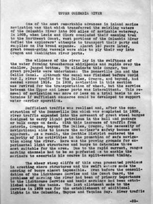
One of the most remarkable advances in inland marine navigation was that which tranferred the swirling waters of the Columbia river into 300 miles of navigable waterway. In 1805, when Lewis and Clark concluded their amazing trek to the Northwest Coast, vast portions of the Columbia River defied the explorers' attempts to transport their party and supplies on its broad expanse. Almost 140 years later, great ocean-going vessels were able to ply their way into Oregon and Washington river ports.
The wildness of the river lay in the swiftness of the water forming treacherous whirlpools and rapids over the shallow, jagged bottom. To eliminate this danger, two great projects were undertaken: The Bonneville Dam and the Celilo Canal. Although the canal was finished before World War I, river traffic to The Dalles, Oregon, and beyond, had ceased around 1916. In 1932, navigation in this section was revived for the transportation of wheat, but the service between the Upper and Lower ports was intermittent. This renewal of navigation was more or less on a trial basis to determine if sufficient commerce could be developed to support water carrier operation.
Sufficient traffic was realized and, after the construction of the Bonneville Dam which was completed in 1938, river traffic expanded into the movement of great steel barges designed to carry liquid petroleum in the hull and package or bulk cargo on deck. With this increase of traffic from Astoria, Oregon, beyond The Dalles, Oregon, the necessity of navigational aids to insure the mariner's safety became most apparent. As a result, the Seattle District centered the majority of its activities in the promotion of safe navigation along the river. Here was the proving grounds for experimental light structures and buoys to determine those most suitable for the area. Due to the rapid current, ranges marking channels had to be so perfected as to enable the mariners to ascertain his course in split-second timing.
The sheer steep cliffs of this area presented problems in erecting shore structures and the swift waters made the mooring of buoys almost impossible. Even before the consolidation of the Lighthouse Service and the Coast Guard, the problems of marking the river had been of primary importance to the Lighthouse Service and basic markings had been established along the banks. The last allotment made to the Service in 1939 was for the establishment of additional lights in the Columbia, Umpqua and Yaquina Bay. River traffic
-25-
Correspondence of LH board 1901-1910
32
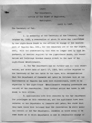
War Department, Office of the Chief of Engineers, Washington.
April 2, 1907
The Secretary of War.
Sir:
1. By authority of the Secretary of the Treasury, dated October 24, 1888, a reservation of about 36 acres was transferred by the Light-House Board to the officer in charge of the improvement of Yaquina Bay, Ore., for the temporary use of the War Department, with the understanding that when no longer used by that Department, or whether required by the Light-House Board, the reservation and buildings thereon should revert to the care of the Light-House Establishment.
2. The War Department has no further use for this reservation, and under date of April 17, 1906, this office reported to the Secretary of War the facts in the case, with recommendation that the Department of Commerce and Labor be informed that as the improvements of Yaquina Bay have been discontinued, there is no objection to the Light-House Establishment resuming possession and control of the reservation. What further action was taken is not known to this office.
3. Applications have been received by the War Department for privileges on this reservation, and the applicants have been referred to the Department of Commerce and Labor, who state that they have there been informed that the reservation is still under the control of the War Department. Inasmuch as there seems to be some doubt as to which Department is now in responsible charge of
